Satellite images reveal extent of Feb. 6 quake destruction in Hatay
Data scientist Yohan Iddawela has shared NASA satellite imagery of nightlights to reveal the scope of the destruction in Turkey’s southeastern Hatay province after the two 7.4 and 7.6 magnitude earthquakes of Feb. 6.
Duvar English
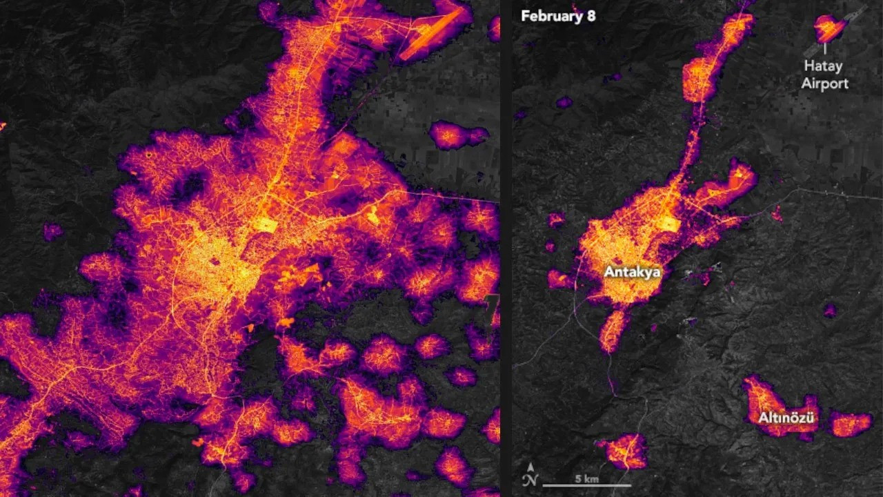
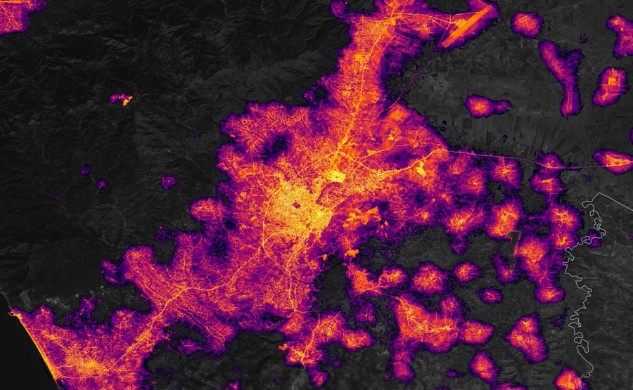
Images taken before and after the earthquake demonstrated the scope of infrastructural damage in Hatay. Almost all streetlights in the periphery of the province were out after the earthquake.
NASA is massively increasing the resolution of nightlights data to measure the impact of natural disasters.
— Yohan Iddawela (@yohaniddawela) January 9, 2024
Here's what you need to know about it: pic.twitter.com/5f2eRMbFhW
Iddawela shared the findings on his social media account. He wrote, “On 6 Feb 2023, two massive earthquakes hit southern Turkey and northwestern Syria. The confirmed death toll was 59,259, and it caused severe destruction of infrastructure. Using downscaled nightlights data from NASA, we're able to visualise the impact on electricity outages.”
Images of street lights from Feb. 4, two days before the earthquakes show the normal state of infrastructure in Hatay.
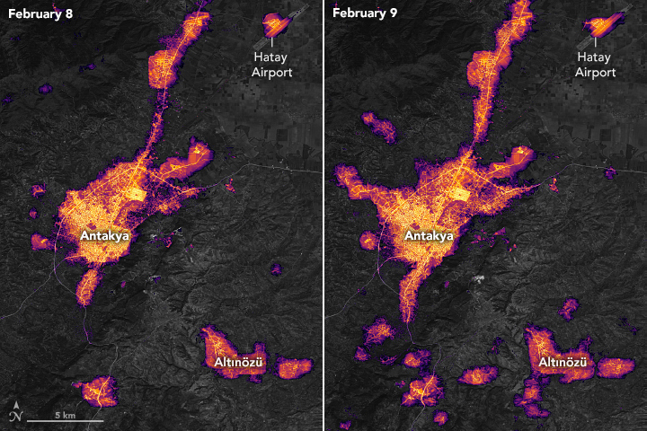
Feb. 8 and 9 images show blackouts in many centers and most periphery districts on Hatay.
As the first anniversary of the earthquake approaches, some of the citizens of affected provinces still live in temporary housing units.
The infrastructural shortcomings persist and survivors still have difficult access to proper housing, power, hygiene, education, and healthcare.

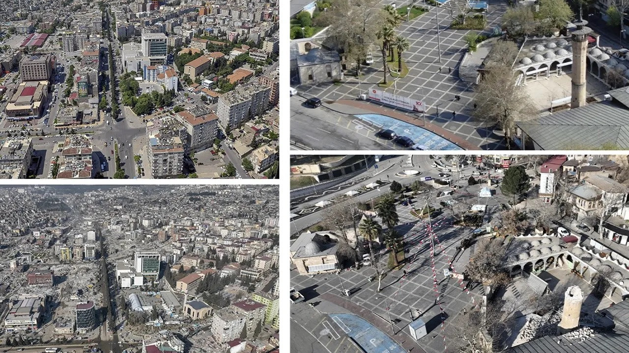 Before and after: Photos show destruction in two quake-stricken provincesDomestic
 Drone images show destruction in quake-stricken Hatay provinceDomestic