
Mapping Kanal Istanbul
The map drawn from the ÇED report shows eight spots through which the canal would cross. These passages have been determined. This provides clues to the land subdivision and transportation network that connects Istanbul, the Marmara Sea and the Black Sea.
In reaction an Environmental Impact Assessment (ÇED) report over the Kanal Istanbul project, objections have swelled. Yet for all the controversy it has caused, the Kanal Istanbul project remains unclear. Its essence has not been disclosed to the public. We are deliberately left short of the power to critique the government and its project.
In an attempt to fill this information gap, I shall map out the share of land that would be dedicated to the project, the way land would be subdivided as well as the zoning and transportation areas that would emerge from it. I will do this using the available reports and images. In other words, I shall draw the picture of the Kanal Istanbul project and explain the politics and economics that surround it.
In 2011, the settlements that would arise on the banks of the artificial canal were evaluated at a population of 1.2 million people. In 2015, without providing any explanation, Erdoğan cut down this figure to 500,000 people. But realistic is this? The ÇED report estimates the excavation and infrastructure costs of Kanal Istanbul at 75 billion liras. In previous reports drawn up by the Ministry of the Environment and Urbanization, this figure exceeded 100 billion lira. The prospected population settlements may be too low to bear this cost. While the government says the "new city" population is directly related to the construction costs of the project, there is no realistic analysis or statement has been put forward that convincingly correlates this relationship.
Land surrounding the would-be route of Kanal Istanbul are already being sold at a rapid pace. 30 million squares of land have already changed ownership. Still, information is scarce regarding the value of this land, the amounts of money exchanged in transactions and the identity of the new owners. In a free market economy, population density, land subdivision and development plans determine the profit returns of land and its value. A population estimate can only be provided if these factors are taken into account.
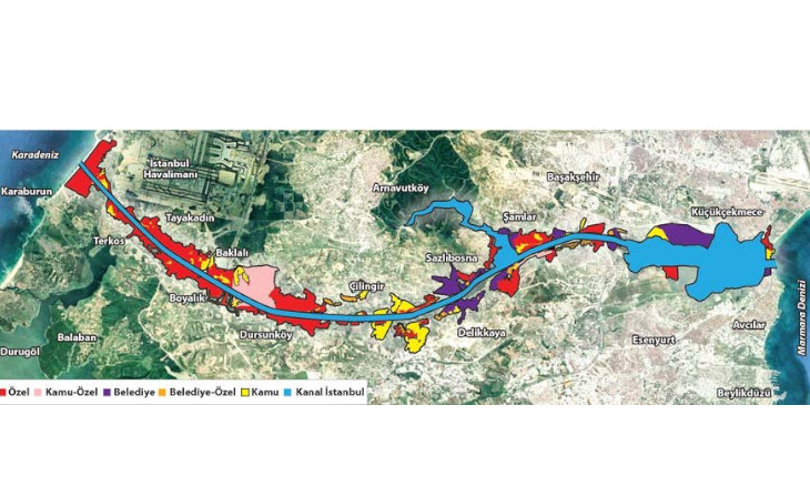
In the ownership map, one can see that privately-owned plots are concentrated around the most valuable region, close to the airport. Plots in this area are valuable because of scarcity. Due to their location, these available plots around the airport can generate profits. As a last point, since the private ownership of these plots would be a monopolistic, absolute returns would be generated im addition to the scarcity and location profits. With these three different types of profit, one can imagine Kanal Istanbul as a Black Sea city.
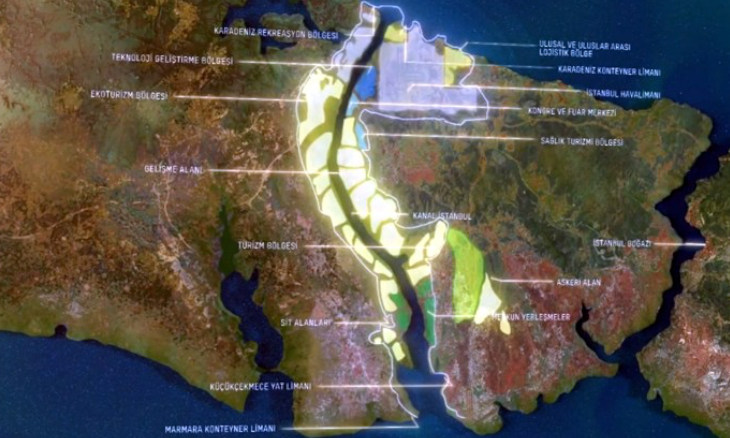
Though the map featured in Kanal Istanbul's promotional video consisted of specific areas dedicated to recreation, ecotourism, health tourism, technology development, congress and fairs, much of it will obviously be made up of residential and business districts. The people who would settle there would benefit from the services provided by the project as well as from the proximity of an international airport. By now it appears clear enough that the state-of-the-art Istanbul Airport was built in this region not for Istanbul residents, but for the future residents of Kanal Istanbul.
The map drawn from the ÇED report shows eight spots through which the canal would cross. These passages have been determined. This provides clues to the land subdivision and transportation network that connects Istanbul, the Marmara Sea and the Black Sea. The value of the plots below the would-be bridges are again to be determined by scarcity, position and absolute returns. If it may be true that a population settlement of 500,000 residents is considered for the area, development plans drawn according to this figure is unlikely to be respected by capital owners.
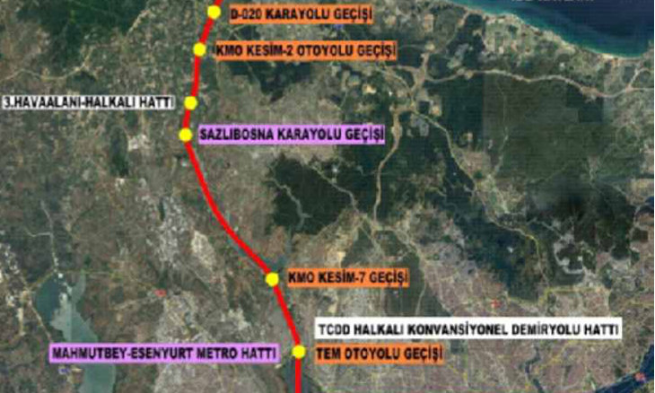
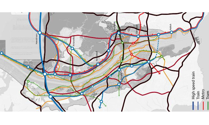
Besides, the report does not provide any information regarding the transportation network, except for bridges. Though it is not an official document, a transportation network map prepared by a consortium of engineering firms made up of the Turkish Dome Architecture, the American HOK and the British BuroHappold does provide information on the area's transportation requirements.
Another important aspect of the project is the "intensity/green space" relationship. Settlements are designed as large swathes of land. Their boundaries are determined by long and thin green areas. But once highways and railroads pass through these green spaces, the green spaces with lack depth on the roadsides. Profit opportunities will again determine the green space ratio within the settlement areas.
Kanal Istanbul would be built from scratch. This "new" Istanbul would be a city devoid of any industrial production and would therefore rely exclusively on the service sector. It would be a city made up of high-income groups and white-collars. What would be built on the land would directly be related to the needs of these social classes.
In line with the AKP's usual practices when it comes to urbanization, profit opportunities would largely determine the manner in which the new city would be developed, regardless of rules and regulations.
Profit opportunities will also determine the outcome of supposedly protected agricultural land that is located close to the prospective Kanal Istanbul. If the the value of the land for development exceeds agricultural production value, the land would become urban.